About Walmer
Although most people would consider the Walmer of today a relatively quiet mainly residential seaside town, it certainly had a turbulent past.
Julius Caesar and his legions are said to have first landed on Walmer beach in 55BC. Ruins around the old St Mary's Church, in the original Walmer Village area, are linked to the Norman Conquest and the Auberville family who came with the invasion.
Following his quarrel with the Pope and fearful of invasion, Henry VIII ordered the building of the 'Three Castles which keep The Downs' - Deal, Walmer and Sandown - in 1540. In the Civil War, they were taken by Cromwell, within 13 days. Today, Walmer Castle and its beautiful formal gardens are a major attraction for visitors. The official residence of Lord Warden of the Cinque Ports since the 18th Century, the building is now an English Heritage property and features a collection of memorabilia of the Duke of Wellington, of Battle of Waterloo fame, who made Walmer his home for 23 years.
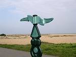
As part of the long-distance Saxon Shore Way, the unspoilt shingle beach is especially popular with walkers and cyclists, taking advantage of an extensive hard-surfaced promenade. Excellent views of Channel shipping and the coast of France, the prospect of free summertime band concerts and a range of services on The Strand are among the other attractions.
Walmer's close neighbour, the town of Deal, provides excellent shopping and leisure facilities. For many visitors, exploring the picturesque rows of cottages between the High Street and the seafront is a special delight. Deal also has one of the south-east's few remaining piers, popular with anglers and said to be the same length as the Titanic!
Walmer Statistics
Walmer Parish land area 939 acres (380 hectares)
Population* total: 6,729 persons (comprising 3,178 males and 3,551 females)
Total number of households* 3,216 (* source: 2021 census)
More information based on the 2021 census is available on Dover District Council's area profile and on the Office for National Statistics' Nomis search (insert "Walmer" in the search box).
Council tax
Levied by Dover District Council. The amounts include precepts for Dover Council, Kent County Council, the Police and Crime Commissioner for Kent, Kent and Medway Fire and Rescue Authority and town and parish councils including Walmer Town Council. Dover District Council's website has more details...
| 2021 Census: Change in local population from 2011 to 2021 | |||||
Deal Urban Area | 2021 Census | 2011 Census | |||
total population | male | female | households | total population | |
Total 4 Wards | 29,289 | 13,936 | 15,353 | 13,589 | 30,085 |
| Middle Deal | 7,717 | 3,609 | 4,108 | 3,328 | 7,414 |
| Mill Hill | 7,866 | 3,789 | 4,077 | 3,362 | 7,851 |
| North Deal | 6,977 | 3,360 | 3,617 | 3,683 | 7,386 |
| Walmer | 6,729 | 3,178 | 3,551 | 3,216 | 7,434 |
| (sources: 2011 and 2021 census data published by Kent County Council and NOMIS) | |||||
| Quick links to more information | |||
| Maps - past and present | Photo albums | Local history | |
| Local events diary | Public transport | Other Walmers - other places called Walmer | - Walmer's adjoining parishes |

